The route between Newcastle-under-Lyme and Derby was one of the major commercial highways in Staffordshire and it was a significant stage coach route. In medieval times the route linked the Earl of Lancaster's castle at Tutbury with his 'New Castle' in the town which grew around it. As the Earls were also Lords of the Manor of Uttoxeter it was inevitable that Newcastle and Uttoxeter would have strong trading links making use of this road.
In 1759 a Private Act of Parliament (32 Geo.II c60) was granted ‘for the repairing of the road between Derby and Newcastle’ and as a result the Uttoxeter to Blythe Marsh Turnpike Trust was established. There were 4 toll gates on the 11 mile section of turnpike. They were at near the modern locations of The Parks at Uttoxeter, Waterloo Farm at Beamhurst, Near Fourtrees between Checkley and Lower Tean, and at Totmoslow near the junction of Cresswell Old Road.
Although Blythe Bridge is now used to describe the whole area, originally it referred to the bridge over the river Blythe near what is now Blythe Bridge station. Blythe Marsh was the area near the Duke of Wellington public house (now Tesco Express) and the turnpike ended at the junction of Uttoxeter Road and Cheadle Road.
This also became an important coaching route. Long distance coaches from Manchester to Birmingham joined the Blythe Marsh Turnpike at Tean and travelled along it to the rest halt at the White Hart in Uttoxeter.
At this time travellers coming from Uttoxeter would get to Deadman’s Green and then the road swung to the left down the narrow and winding Old Road into the village of Checkley, past the Red Lion and the church and it would turn left at the top of Church Lane to follow the line of the current road towards Tean.
In 1822 a new section of turnpike road was built to link Deadman’s Green directly to the top of Church Lane thus avoiding the village and this of course is the route of the current main road, the A522. As far as can be established the turnpike roads through Checkley were never ‘McAdamised’.
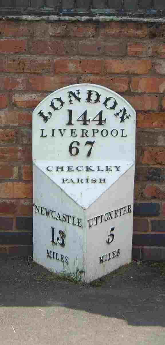
Under the ‘General Turnpike Act’ of 1767 the Turnpike Trusts were directed to erect mile-stones on their roads and an example of one of these can be seen near Green Park at Deadman’s Green (see photograph). This one was made by I & F Thornewill at Burton on Trent in 1828.